Dark Sky Studio
Sea Coal Map
Sea Coal Map
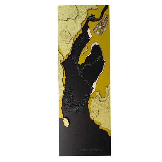
The Flow & Firth Map collection traces the contours of the River Dee as it winds through Kirkcudbright Bay to the Solway Firth.
A bold and graphic interpretation, inspired by sea coal, etched textures, and deeper coastal tones.
Features:
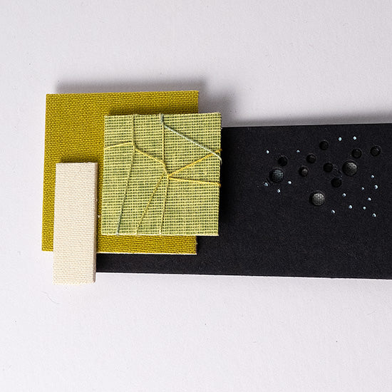
• Two tone green topographical landscape embellished with basket weave stitch
• Black tidal waters with multiple holes representing the River Dee (graduated blue fabrics)
• Mud flats with etched text
• 26 navigational buoys
• Kirkcudbright town zone in light grey
• Etched type- Kirkcudbright Bay, Little Ross, Milton Sands
Encased in a 71cm X 31cm white painted wooden frame (4.5 cm deep), fitted with a durable cotton cord for secure wall display. Hangs vertically because of etched Kirkcudbright text. This art map is hung vertically.
Couldn't load pickup availability
Share


